Dry Sandford Pit
Disclaimer: Whilst effort has been put into ensuring the information provided here is correct, all information is provided "as is" with no guarantees on accuracy. It is highly recommended that you seek out other sources of information (such as those in the Links section of each locality, as well as any other information you can find) before setting off. However, be aware that the Oxford University Geological Society is unable to comment on the accuracy of information provided in any linked external websites.
These pages do not provide any risk assessments. Be aware of your surroundings at all times in the field and do not undertake excursions unless you are comfortable with the risks associated with going into the field. Be mindful of both your safety and the safety of those around you if you choose to undertake any excursions.
These pages do not provide any risk assessments. Be aware of your surroundings at all times in the field and do not undertake excursions unless you are comfortable with the risks associated with going into the field. Be mindful of both your safety and the safety of those around you if you choose to undertake any excursions.
Overview
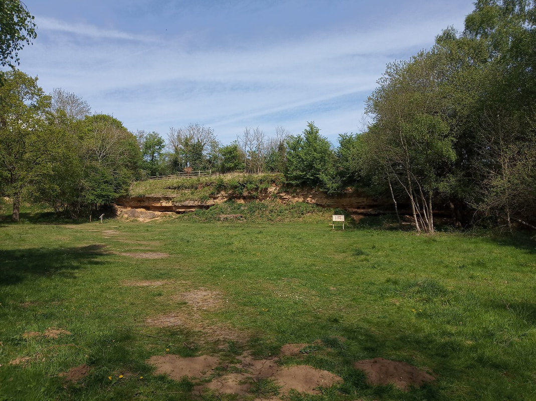
Dry Sandford Pit is a nature reserve set in an old sand quarry[1] located approximately 5.4 miles SW of the Department. Access around the site was via paths.As most of these paths are permissive footpaths, please keep to them. The site is an SSSI. Damaging, digging or removing material from this site is illegal (e.g. see the BBOWT webpage for this locality; website visited on 9th June 2023).
Outcrops
Outcrops were mainly in the form of short but unstable cliffs. There were two main outcroppings here (see above map):- Outcrop 1: Along the left (when going into the site) path.
- Outcrop 2: Further into the site, requiring a bit of navigation around the many paths.
|
|

Geology
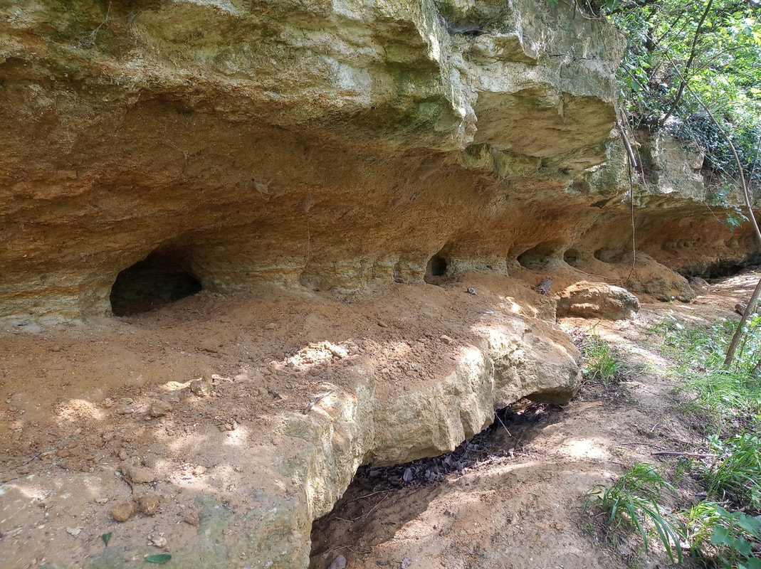
The old quarry here was carved into the uppermost 7 m or so of the Late Jurassic (Oxfordian) Beckley Sand Member (Kingston Formation)[2]. Roughly horizontal limestones and sandstones are exposed in alternating layers, the sandstones generally being less resistant to weathering and erosion. These sandy layers are also burrowed by insects and small mammals. The limestone layers are fossiliferous, with ammonites, coral, sea urchins, gastropods and bivalves (which seem to be the most common) present[3].|
|

See Also
- https://www.bbowt.org.uk/nature-reserves/dry-sandford-pit
- https://www.ogg.rocks/cothilldry-sandford-pit
- https://www.oxford-rocks.co.uk/listings/dry-sandford-pit-nature-reserve
References
- Natural England (1970). Dry Sandford Pit Citation, https://designatedsites.naturalengland.org.uk/PDFsForWeb/Citation/1001806.pdf
- British Geological Survey (2023). Geology of Britain Viewer, http://mapapps.bgs.ac.uk/geologyofbritain/home.html. Visited 7th March 2023.
- Arkell, W. J. (1936). The Ammonite Zones of the Upper Oxfordian of Oxford, and the Horizons of the Sowerbys’ and Buckman’s Types. Quarterly Journal of the Geological Society, 92(1–4), 146–187. https://doi.org/10.1144/GSL.JGS.1936.092.01-04.09 (Dry Sandford section description page 156-157)
