Mapping ProjectPreparing for and planning your mapping project can often seem like a daunting task, and can also prove time-consuming if you're not too sure about what you're doing.
To help get you started, a number of past undergraduates have put together some guidance and advice about what to consider when planning your project, as well as a list of ideas for where in the world you might want to map: |
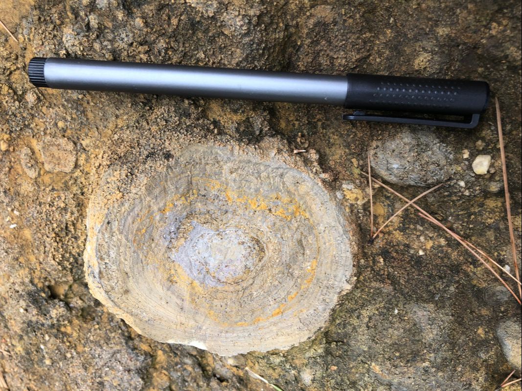
An oncoid observed in the field next to a pen for scale.
|
|
You can theoretically do your mapping project anywhere in the world, but in reality only certain places are actually suitable for mapping. Deciding where to map can often prove to be one of the most difficult tasks for many mapping groups. This section of the website aims to help you with making your choice by highlighting some of the areas that past undergraduates have gone to. For each area, undergraduates who have mapped there also list various logistical factors from their experiences including the costs, accessibility, climate and the typical rock types you might expect. Whether you decide to map somewhere that's been mapped before, or want to go somewhere completely new, we hope this section will both inspire you and help you to assess the suitability of various mapping areas in the world. |
Don't forget to also thoroughly read the Undergraduate Handbook and the Mapping Project Guide (which you'll be given at some point during your 2nd year or you can find on Weblearn) for information on specific project deadlines, as well as further advice on how to choose a suitable area and what you'll need to include when you hand in your project. Additional information, including about fieldwork safety and funding opportunities, can be found on the Earth Sciences Department’s Field Courses page.
|
Copyright © 2020 Oxford University Geological Society
|
